click image for full size
|
|
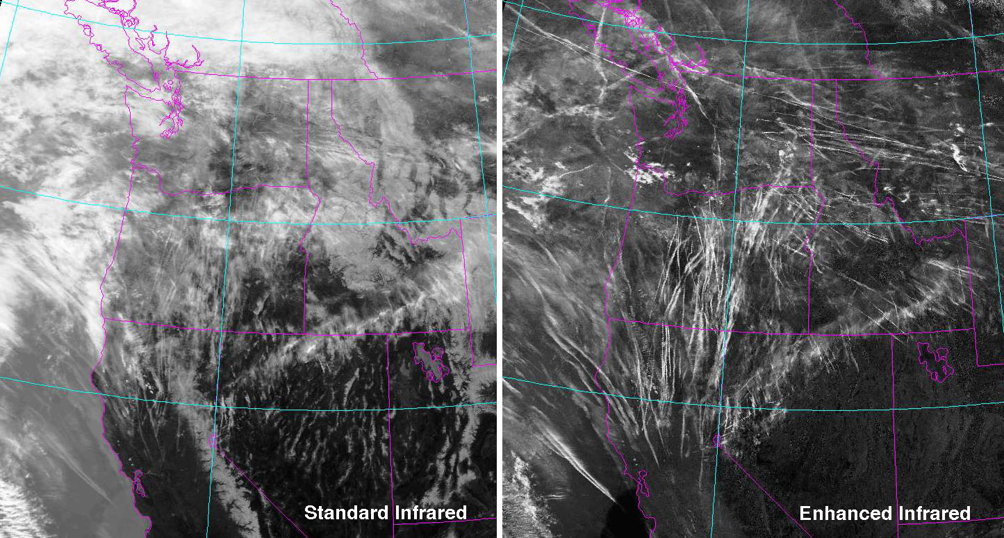
These images from the NOAA-17 satellite taken during the morning of March 20, 2004
show how a contrail outbreak can appear to be regular cloud cover but is, infact,
mostly spreading contrails. The image on the left is a standard infrared
satellite image, while that on the right uses two infrared wavelengths to reveal
contrails. Many of the contrails appear to be from planes either coming from or
going to central and southern California, while others are due to planes on sout
heast-northwest tracks into Seattle and Portland. The contrails and resulting cirrus
clouds travel eastward during the day.
|
|
For other Aviation Emission related documents at the EPA, visit http://www.epa.gov/otaq/aviation.htm
|
Related References
|
Related Web Sites:
Southern Great Plains (SGP) Site Data System (SDS)
SUCCESS Home Page
NASA Langley SUCCESS Page
This page was last modified on 26th Nov 2001.
|

